
Saginaw Township ZIP Code Directory Areas
The local postal reference begins with four principal ZIPs listed for Saginaw Charter Township in the Saginaw Future county profile: 48602, 48603, 48604, and 48638. Those are a service-area profile, not a parcel-by-parcel boundary decision. The township is adjacent to the City of Saginaw, and all four principal ZIPs use Saginaw as a postal city in common addressing. A record search should therefore save both the ZIP and the municipality confirmed by parcel, assessor, or GIS evidence.
| Postal area | Area described in the research | Post office or station | Record-search note |
|---|---|---|---|
| 48602 | Saginaw postal area and portions near the township’s southern and eastern context on available maps | Specific station not located | A Saginaw postal city is not proof of township jurisdiction |
| 48603 | Principal Saginaw Township postal area | USPS Township Branch, Saginaw | Do not infer parcel-by-parcel township coverage from the station record |
| 48604 | Saginaw postal area serving portions of the broader township and service area | Specific station not located | Precise township share was not established |
| 48638 | Saginaw Township postal and service area with central, west, and south context | Specific station not located | Verify a particular street through parcel data |
Nearby 48608 and 48663 labels appear in mapping material, but the research did not establish them as principal Saginaw Township ZIPs. They should not be added to a ZIP code directory without parcel-level confirmation.
Four Saginaw Township Postal Areas
The four-ZIP description comes from a local profile rather than a single postal-boundary file. The state ZIP map and the SAGA county ZIP map show a wider Saginaw-area pattern, including nearby postal labels. That wider pattern is useful context for a ZIP search, but the sources do not map every township street to a precise ZIP boundary. No official source in the research established a township-specific ZIP split, realignment year, PO-box-only ZIP, or unique ZIP assigned to a single institution.
Keep the language narrow when using a postal reference. A result can say that a ZIP serves part of the township’s postal area. It should not say that every address in that ZIP is in Saginaw Township. For a legal or administrative question, the parcel’s situs address, local assessor record, and SAGA map context are more reliable than a postal-city line.
Note: The four principal ZIPs are a local service-area statement, so confirm a particular delivery address with USPS and the township with parcel records.
Saginaw Township 48603 at Township Branch
Of the four principal ZIPs, 48603 has the clearest postal location record found in the research. The USPS page identifies Township Branch, Saginaw, Michigan 48603-2363. That is useful confirmation that a postal facility uses 48603. It does not prove that every 48603 delivery address sits within Saginaw Township, and it does not establish that Township Branch is the only facility relevant to township residents.
Use the postal location record for a delivery-location question. Use an assessor, deed, or GIS record for ownership, parcel identity, or municipal limits. Mixing those tasks is the most common way a postal reference can overstate what a result means.
The USPS Township Branch location record is the source for the 48603 postal-facility detail.
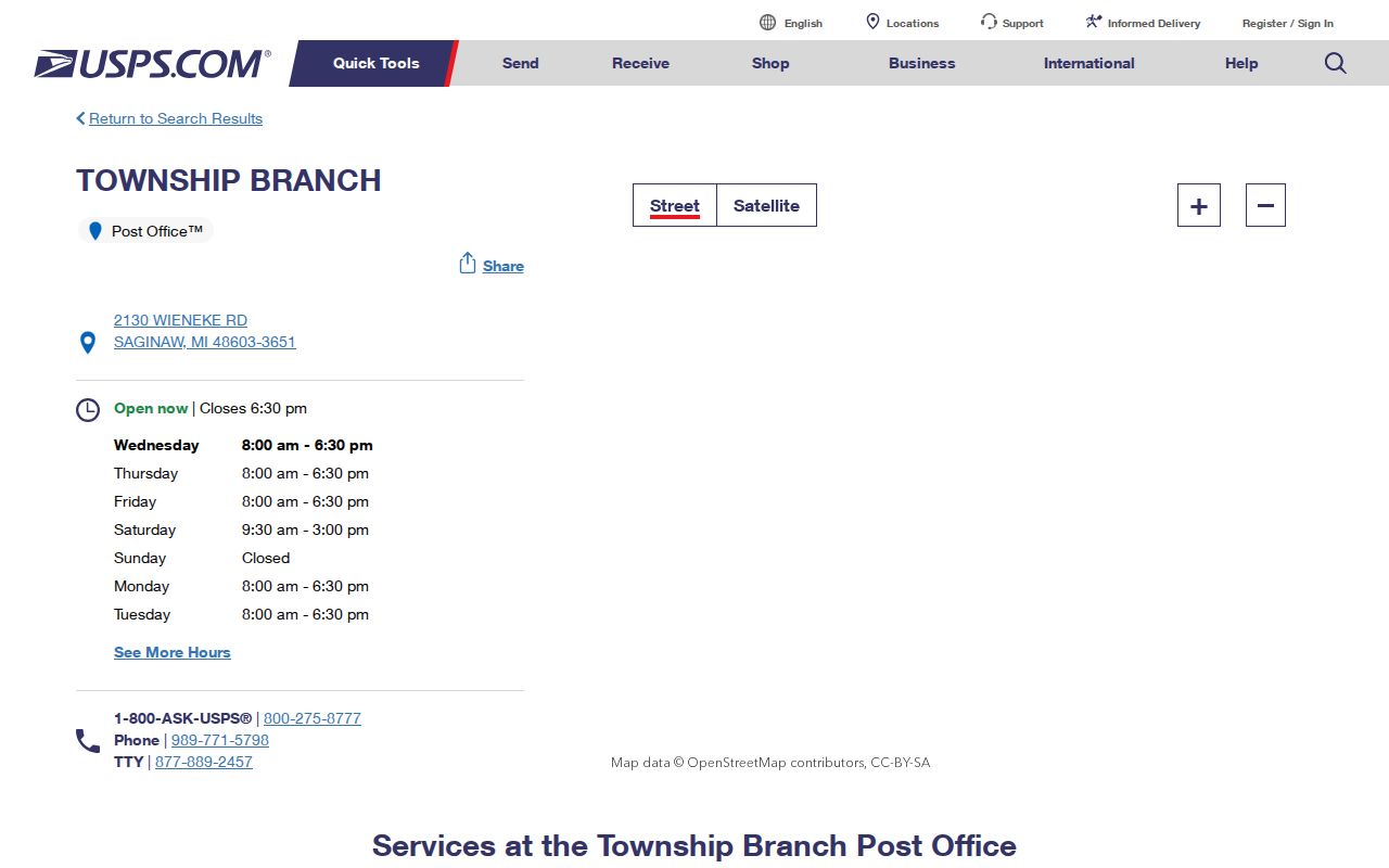
The facility record supports the 48603 postal reference, while a parcel lookup remains necessary for any township-boundary conclusion.
Saginaw Township ZIP Geography Is Not a Boundary
ZIPs are delivery geography. Township boundaries are governmental geography. In Saginaw County, that difference is especially important because Saginaw Charter Township lies next to the City of Saginaw and other townships. A Saginaw mailing address can belong to a city parcel, a township parcel, or a nearby township parcel. The state and SAGA ZIP maps provide helpful regional context but do not replace a legal description, survey, assessor record, or parcel map.
The township parks master plan identifies the Tittabawassee River on the west, the City of Saginaw and Carrollton Township on the east, Thomas Township on the west, James Township on the south, and Tittabawassee and Kochville townships on the north. These borders explain why a postal result should be treated as one part of the record trail. M-47, M-84, M-58, and M-46 are useful geography clues, especially near a jurisdiction edge, but are not boundary rules.
Postal-label check. Record “Saginaw Charter Township, Saginaw County” separately from the USPS city label, then confirm the municipality through a parcel or GIS record.
Find Residents Within a Saginaw Township ZIP
A ZIP can help narrow an address check, but the public sources do not support a ZIP-wide township resident list. SAGA Fetch supports address, owner-name, and parcel-number searching and offers ZIP map layers. BS&A advertises address, name, and parcel searches for property and tax categories. The research did not verify a ZIP filter in either system. The Michigan Voter Information Center follows an individual address and registration workflow; it is not a ZIP-wide roster.
- Confirm the mailing ZIP through the appropriate USPS tool or postal location information.
- Search the full street address in SAGA Fetch or the Saginaw Township BS&A property route.
- Record the situs address, parcel number, legal description, and municipality shown by the property record.
- Use available ZIP, school, or commission layers only as map context, then compare the parcel with the township boundary context.
- When the question becomes street-by-street rather than ZIP-by-ZIP, use the Saginaw Township Street Directory for the full parcel-to-deed workflow.
Do not imply that a public voter record creates a ZIP directory. Michigan protects several voter-file fields, and the research did not locate a county bulk-file request form, pricing, file format, or delivery schedule for a ZIP extract.
Saginaw Township Postal Search Fields
The available official material documents several address-search concepts, but not a verified ZIP-filter form. The table separates what was captured from what remains a research gap. It avoids turning a possible advanced field into a promised ZIP-filter function.
| System or field | Documented status | What it helps confirm | Limit |
|---|---|---|---|
| SAGA Fetch address search | Address, owner name, and parcel number concepts are verified | Parcel and mapped address context | Exact visible controls were not captured |
| SAGA ZIP layer | ZIP map layers are documented | Postal geography near a parcel | Not a legal boundary or resident list |
| BS&A property route | Address, name, and parcel searching are advertised | Property, tax, sales, and assessing categories | ZIP filter and ZIP-wide return behavior were not verified |
| County district map | Uses address number and street name | Precinct or district context after an address match | Not a ZIP search |
| MVIC | Address and registration workflow is documented generally | Individual registration context within public limits | Live field labels and ZIP-wide use were not captured |
USPS is the authority for a mailing location. The assessor and GIS layers answer different questions about parcel and municipality. A sound postal search keeps those roles separate.
Saginaw Township Roads as ZIP Geography
The township’s geography can help explain a result that looks inconsistent. The parks plan places Saginaw Charter Township in northeast-central Saginaw County and names major routes M-47, M-84, M-58, and M-46. It also identifies rail corridors and the city and township edges around the community. Those features are useful clues when a Saginaw postal address falls close to a municipal seam.
These local geography facts matter because a postal label can cross the same regional corridors that divide township and city administrative responsibility. Use the road, river, and city-edge context to ask the next record question, then rely on the parcel and legal description for the answer. The physical features do not turn a road or a ZIP into a township line.
Use Saginaw Township Parcels Beyond a ZIP
Parcel numbers are often a steadier bridge than a ZIP when an address has changed, land has been split, or a postal label spans jurisdictions. The Saginaw County assessing guide explains that a new parcel retains the parent’s four-digit quarter-section number and receives the next three-digit sequence. Its example moves from parent and child numbers such as 3001-002 and 3001-003 to later sequences 3001-004, 3001-005, and 3001-006.
Pair the parcel number with a subdivision, lot and block, or metes-and-bounds legal description. SAGA warns that its parcel lines are not survey-accurate, and a replat can change a parcel number. The recorded legal description can persist beyond an old street label or ZIP context. When parcel identity matters, use the Register of Deeds and local assessor channels rather than a delivery label.
Note: A ZIP is a useful search filter or delivery clue, while a parcel and legal description identify land in the assessment and recorded-document systems.
Verify a Saginaw Township ZIP Code Result
ZIP results need a plain-language limit. A ZIP identifies a postal delivery area, and ZIP+4 narrows mail sorting for a more specific address or delivery segment. A PO-box ZIP is used for postal boxes rather than a general street-delivery area. A unique ZIP can be assigned to one organization, while a carrier route is the route used to organize delivery. The research did not locate a Saginaw Township-specific PO-box ZIP, unique ZIP, realignment history, or complete station-by-ZIP table, so none should be inferred.
- ZIP code
- A postal delivery-area label. It is not a municipal boundary or a land description.
- ZIP+4
- An added four-digit delivery-sorting detail attached to a ZIP for a more specific mailing location.
- PO-box ZIP
- A ZIP used for postal boxes. It does not establish a street address or parcel location.
- Unique ZIP
- A ZIP that can be assigned to one organization or institution. No township-specific example was verified here.
- Carrier route
- A postal delivery route. It can aid mailing context but is not a resident or legal-boundary record.
For an official record that is not visible online, contact the custodian and describe the specific address, parcel, date range, and record type. Michigan Freedom of Information Act requests must be written and sufficiently specific, while court records follow separate clerk procedures. Use public records for lawful personal research and never to stalk, harass, or harm anyone.